Detection Rate
45.47%
Total Area
16.48 rai
Detected Trees
5,322
Expected
11,704
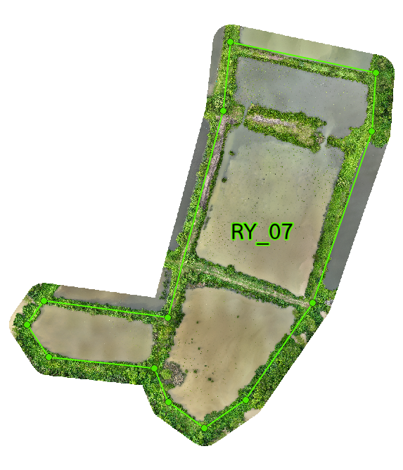
Plot 07 Overview
RY_07 covers 16.48 rai and has 4 subplots. It was planned for 11,704 trees, with 5,322 detected and a 45.47% detection rate. The plot shows a patchy pattern, with better results in a few favorable areas and weaker results elsewhere. RY_07 has mixed performance and sits in the middle-to-lower range of the project. RY_07-1 is the strongest subplot, while RY_07-4 is the weakest. Overall, the plot needs better water control and site improvement to raise survival. Growth stays low in most of RY_07, with only a few better patches near the edges. The center remains weak because drainage and water conditions are still not ideal. More focused site work would be needed to improve canopy development.
Interactive Grid Detection Map
Grid Detection Analysis
This interactive map displays tree detections using advanced AI technology that analyzes multispectral satellite imagery to identify individual mangrove canopies. The surveyed area is divided into a grid system for precise monitoring of tree density and spatial distribution patterns.
Loading map...
Subplot Analysis
Tree Detection Summary
Technical Note
Detection is performed using multispectral drone imagery at 40m altitude. AI algorithms identify individual canopies within the range of 0.09 - 0.36 sqm.