Detection Rate
34.22%
Total Area
14.64 rai
Detected Trees
3,556
Expected
10,391
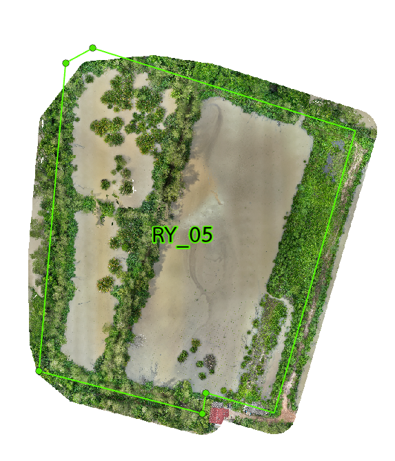
Plot 05 Overview
RY_05 is a 14.64 rai restoration site with 3 subplots. It was planned for 10,391 trees, but only 3,556 were detected, giving the lowest rate in the project at 34.22%. Most surviving mangroves sit near the edges, while the center stays mostly open. RY_05 is the weakest plot in the set. The surviving trees are mostly found at the margins, and all three subplots perform poorly in a similar way. This points to a serious drainage and water-level problem across the whole site. Growth is very limited across RY_05, with almost no strong canopy development. The few better spots are near the edges where drainage is slightly better. Without major water management work, this plot will stay behind the rest of the project.
Interactive Grid Detection Map
Grid Detection Analysis
This interactive map displays tree detections using advanced AI technology that analyzes multispectral satellite imagery to identify individual mangrove canopies. The surveyed area is divided into a grid system for precise monitoring of tree density and spatial distribution patterns.
Loading map...
Subplot Analysis
Tree Detection Summary
Technical Note
Detection is performed using multispectral drone imagery at 40m altitude. AI algorithms identify individual canopies within the range of 0.09 - 0.36 sqm.