Detection Rate
43.5%
Total Area
33.84 rai
Detected Trees
10,451
Expected
24,026
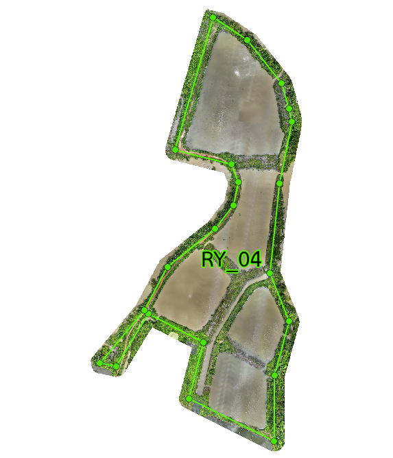
Plot 04 Overview
RY_04 is the largest plot at 33.84 rai, split into 8 subplots. It has 24,026 planned trees and 10,451 detected trees, giving a 43.50% detection rate. The plot is highly mixed, with strong results in the island areas and weaker survival along the edges. RY_04 has the widest range of performance in the project. The island subplots, especially RY_04-2 and RY_04-4, perform well, while the edge and low-lying areas struggle. This shows that elevation and drainage are the main reasons for the difference. Growth is best in the elevated island zones, where normal and high canopy levels cluster. The lower areas stay mostly low in growth because water stays too long and drainage is weak. In short, RY_04 survives in the right places, but it still needs better water control.
Interactive Grid Detection Map
Grid Detection Analysis
This interactive map displays tree detections using advanced AI technology that analyzes multispectral satellite imagery to identify individual mangrove canopies. The surveyed area is divided into a grid system for precise monitoring of tree density and spatial distribution patterns.
Loading map...
Subplot Analysis
Tree Detection Summary
Technical Note
Detection is performed using multispectral drone imagery at 40m altitude. AI algorithms identify individual canopies within the range of 0.09 - 0.36 sqm.