Detection Rate
56.89%
Total Area
18.63 rai
Detected Trees
7,524
Expected
13,225
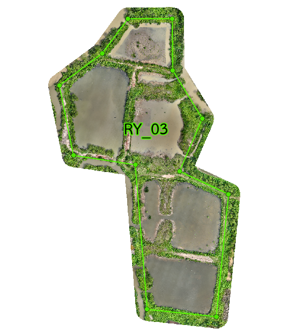
Plot 03 Overview
RY_03 covers 18.63 rai and has 5 subplots. It holds 13,225 planned trees, with 7,524 detected for a 56.89% detection rate. Survival is decent, but growth still varies by location across the plot. RY_03 shows solid survival, but growth is not evenly spread. RY_03-3 and RY_03-4 perform better, especially near areas with better drainage. This means the plot is established, yet some zones still need better water management. Most trees in RY_03 are growing at a low to normal level, with better results at the plot edges. The pattern suggests that small differences in elevation and drainage are shaping growth more than survival. Improving those weaker zones should help the canopy develop further.
Interactive Grid Detection Map
Grid Detection Analysis
This interactive map displays tree detections using advanced AI technology that analyzes multispectral satellite imagery to identify individual mangrove canopies. The surveyed area is divided into a grid system for precise monitoring of tree density and spatial distribution patterns.
Loading map...
Subplot Analysis
Tree Detection Summary
Technical Note
Detection is performed using multispectral drone imagery at 40m altitude. AI algorithms identify individual canopies within the range of 0.09 - 0.36 sqm.