Detection Rate
49.24%
Total Area
25.07 rai
Detected Trees
8,764
Expected
17,800
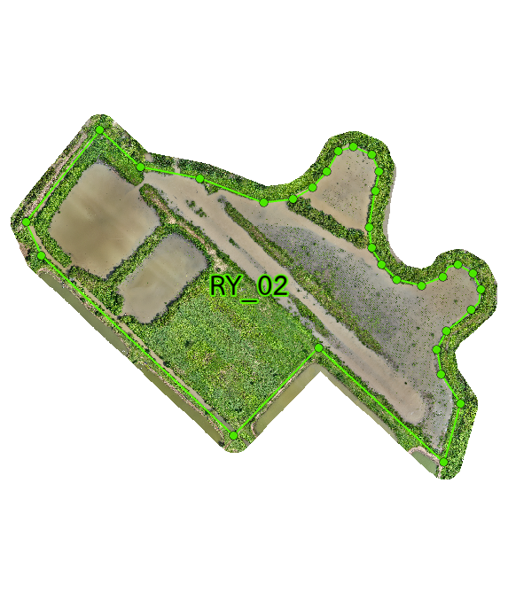
Plot 02 Overview
RY_02 is a 25.07 rai mangrove plot with 3 subplots. It has 17,800 planned trees and 8,764 detected trees, giving a 49.24% detection rate. The plot shows mixed site conditions, with better survival in some lower and better-drained areas. RY_02 performs at a moderate level overall, but the three subplots behave differently. RY_02-2 is the strongest area, while RY_02-1 and RY_02-3 are more limited by water and terrain conditions. This suggests the plot needs more site-specific management rather than one uniform approach. Growth is moderate, with the best canopy development in RY_02-2. The other subplots still show survival, but growth stays limited where water levels are higher. Better drainage in the weaker areas would likely improve performance.
Interactive Grid Detection Map
Grid Detection Analysis
This interactive map displays tree detections using advanced AI technology that analyzes multispectral satellite imagery to identify individual mangrove canopies. The surveyed area is divided into a grid system for precise monitoring of tree density and spatial distribution patterns.
Loading map...
Subplot Analysis
Tree Detection Summary
Technical Note
Detection is performed using multispectral drone imagery at 40m altitude. AI algorithms identify individual canopies within the range of 0.09 - 0.36 sqm.